
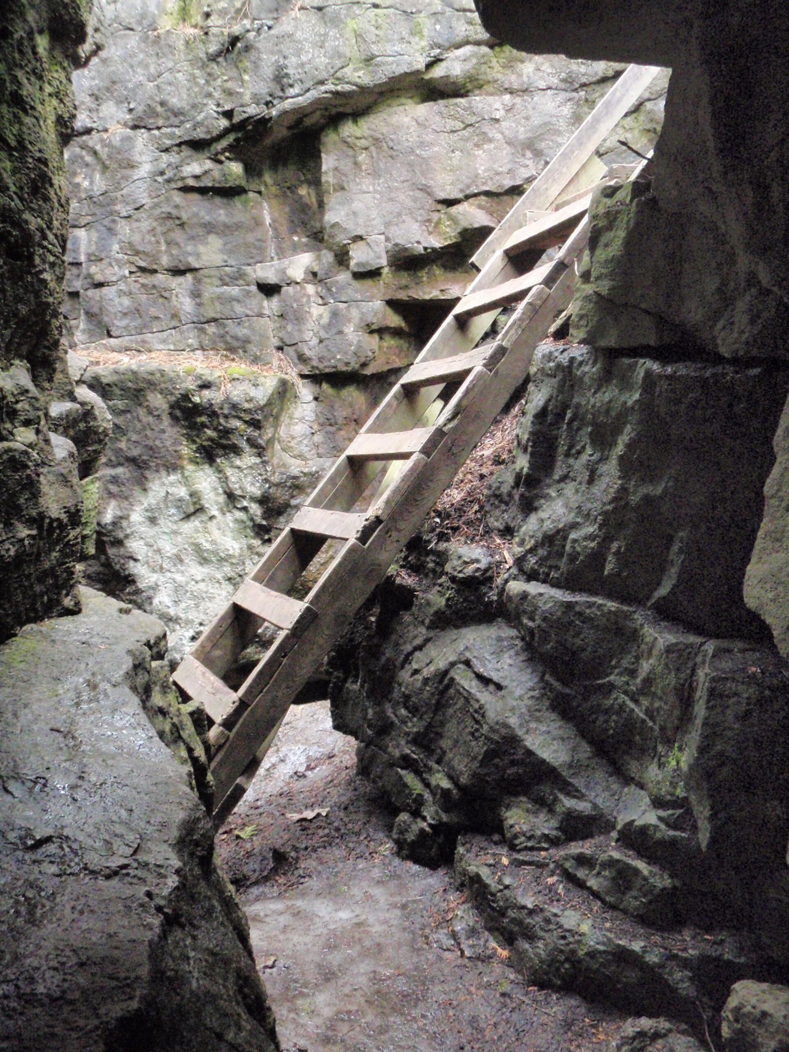
Limehouse Conservation Area in Halton Hills stands out for its blend of rugged escarpment terrain and preserved 19th-century lime kilns. The highlight for most hikers is the “Hole in the Wall,” a natural limestone cleft where sturdy wooden ladders guide you down between towering mossy rock faces into a cool, sheltered trail corridor.
Located just minutes from Acton and Georgetown, Limehouse provides a rugged, immersive hike without the heavy crowds often found at larger provincial parks. This complete trail guide details key geological landmarks, route recommendations, footwear advice, and parking logistics.
1. Quick Facts & Logistics
- Location: 12169 5th Line, Limehouse, ON (Town of Halton Hills)
- Managing Body: Credit Valley Conservation (CVC)
- Admission & Parking: Free day-use access and free roadside parking at the main 5th Line entrance. Secondary access is available near Limehouse Memorial Hall.
- Trail Network: ~4.5 km of interconnected trails, including the main Bruce Trail, Black Creek Side Trail, and the historic Radial Railway route.
- Trail Difficulty: Moderate to Difficult (uneven limestone bedrock, exposed roots, and wooden ladder descents).
- Facilities: The park is maintained in a semi-wilderness state; there are no permanent public washrooms or running water on site. Plan ahead before arriving.
- Dog Policy: Dogs are permitted on a leash on standard woodland paths, but navigating the “Hole in the Wall” ladder crevice is not suitable or safe for dogs.
2. Top Landmarks & Geological Highlights
The “Hole in the Wall”
The signature geological highlight along the Bruce Trail section:
- The Crevice: Deep fissures split the bedrock where ancient dolomite limestone blocks pulled apart along the escarpment brow.
- The Ladder Descent: Sturdy wooden ladders and timber steps allow hikers to climb down directly into the cool, shaded chasm between sheer rock faces.
- Caution: Rocks within the crevice remain damp, mossy, and slick throughout the year. Maintain three points of contact on ladder rungs and mind foot placement along upper fissure openings.
Historic 19th-Century Lime Kilns & Mill Ruins
During the mid-to-late 1800s, this area served as a thriving hub for extracting and processing lime:
- The Draw Kiln: A massive, partially restored stone kiln constructed in the 1870s stands near the trail, showcasing the heavy masonry used to heat limestone into quicklime.
- The Powder House: A historic stone building once utilized to securely store blasting powder for quarry operations.
- Black Creek Mill Ruins & Stone Arch Bridge: Down along the creek bed, hikers can view the stone foundations of an early sawmill and a photogenic stone arch bridge spanning the water.
3. Recommended Hiking Routes
Bruce Trail & Hole in the Wall Loop (Moderate | ~2 km)
The premier loop combining geology and industrial history:
- Leads from the 5th Line parking lot along the main white-blazed Bruce Trail.
- Passes through the Hole in the Wall crevice, weaves past the historic draw kiln and powder house, and loops back via the old Toronto Suburban Radial Railway bed.
Black Creek Side Trail (Moderate | ~1.5 km)
A scenic blue-blazed side trail tracing the cool, clear banks of Black Creek:
- Winds through dense cedar groves and mixed hardwood forest.
- Provides gentle water views and quieter trail sections away from the main crevice feature.
4. Visitor Tips & Nearby Escarpment Trails
- Footwear is Essential: Because of sharp rocks, exposed tree roots, and slick subterranean stone steps, sturdy hiking boots with deep tread are strongly recommended over casual sneakers.
- Pack In, Pack Out: Since the property lacks trash bins and facilities, carry a daypack with water and take all waste with you to help protect this sensitive escarpment habitat.
- Connecting Regional Trails: Pair your visit with nearby Credit Valley and Halton hiking areas. Explore the suspension bridge and river gorge at Belfountain Conservation Area, hike the Cataract Falls loop at Forks of the Credit Provincial Park, or visit the historic longhouse village at Crawford Lake Conservation Area.